-
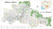
Koh Kong communal land use planning (CLUP) atlas 2009
 Cambodia
April 18, 2017
Source: Ministry of Land Management, Urban Planning and Construction...
Cambodia
April 18, 2017
Source: Ministry of Land Management, Urban Planning and Construction...
 Koh Kong communal land use planning(CLUP) atlas (Andong Tuek, Chrouy Pras, Smach Mean Chey, Stung Veng, Tma Sa, and Trapeang Rung commune) is communal land use planning extracte...
-
Ratanakiri communal land use planning (CLUP) atlas 2009
Cambodia
April 18, 2017
Source: Ministry of Land Management, Urban Planning and Construction...
 Ratanakiri communal land use planning(CLUP) atlas (Aekakpheap, Ka Choun, Pong, Sameaki, Serei Mongkol, and Toen commune) is communal land use planning extracted from 2009 contai...
-
Siem Reap communal land use planning (CLUP) atlas 2009
Cambodia
April 18, 2017
Source: Ministry of Land Management, Urban Planning and Construction...
 Siem Reap communal land use planning(CLUP) atlas (Chan Sar, Doun Peaeng, Leang Dai, Nokor Pheas , Popel, Srae Khvav, Svay Chek, Tayaek commune) is communal land use planning ext...
-
Kampong Speu commune land use planning (CLUP) atlas 2009
Cambodia
March 29, 2017
Source: Ministry of Land Management, Urban Planning and Construction...
Kampong Speu commune land use planning(CLUP) atlas (Kiri Vaon, Moha Sang, Honorom, Prabei Mom, Prey Khmeng, and Yea Angk commune) is communal land use planning extracted from 20...
-
Kampong Cham communal land use planning (CLUP) atlas 2009
Cambodia
April 18, 2017
Source: Ministry of Land Management, Urban Planning and Construction...
 Kampong Cham communal land use planning(CLUP) atlas (Chikor, Moung Riev, Roang, and Srak commune) is communal land use planning extracted from 2009 contained both detailed curre...
-
Mondulkiri communal land use planning (CLUP) atlas 2009
Cambodia
April 18, 2017
Source: Ministry of Land Management, Urban Planning and Construction...
 Mondulkiri communal land use planning(CLUP) atlas (Dak Dam, Pu Chri, Saen Monourom, Srae Ampum, Srae Khtum, and Srae Preah commune) is communal land use planning extracted from ...
-
Preah Sihanouk communal land use planning (CLUP) atlas 2009
Cambodia
April 18, 2017
Source: Ministry of Land Management, Urban Planning and Construction...
Preah Sihanouk communal land use planning(CLUP) atlas (Angdoung Thma, Kampenh, Outreh, Samrong, and Tomnob Rolok commune) is communal land use planning extracted from 2009 conta...
-
Kep communal land use planning (CLUP) atlas 2009
Cambodia
April 18, 2017
Source: Ministry of Land Management, Urban Planning and Construction...
Kep communal land use planning(CLUP) atlas (Angkaol, Ou Krasar, and Pong Tuek commune) is communal land use planning extracted from 2009 contained both detailed current land us...
-
Kratie communal land use planning (CLUP) atlas 2009
Cambodia
April 18, 2017
Source: Ministry of Land Management, Urban Planning and Construction...
 Kratie communal land use planning(CLUP) atlas (Dar, Kbal Damrey, O Krieng, Ruessei Kaev, Saob, Srae Char, Svay Chreah, and Thmi commune) is communal land use planning extracted ...
-
Special Economic Zones & Cross Border Economic Zones in the Mekong
Cambodia, China, Lao People's Democratic Republic, Myanmar, Thailand, Viet Nam
June 26, 2015
Source: Asian Development Bank Environment Operations Center (www.gms-eoc.org).
A geospatial dataset describing SEZ and CBEZ of the Greater Mekong Subregion. It contains 416 SEZ and CBEZ including attributes (name, type, country and code).
-
Greater Mekong Subregion Economic Corridors 2012
Cambodia, China, Lao People's Democratic Republic, Myanmar, Thailand, Viet Nam
July 9, 2015
Source: Asian Development Bank / Environment Operations Center...
A dataset containing trans-boundary roads declared Greater Mekong Subregion transport corridors and their status as of 2012 -- existing, planned, potential.
-
GMS Main Tourist Sites
Cambodia, China, Lao People's Democratic Republic, Myanmar, Thailand, Viet Nam
July 13, 2015
Source: Asian Development Bank / Environment Operations Centre...
This dataset contains 120 major GMS tourism sites.
-
GMS Aqueduct Atlas
Cambodia, China, Lao People's Democratic Republic, Myanmar, Thailand, Viet Nam
July 26, 2015
Source: Gassert, F., M. Luck, M. Landis, P. Reig, and T. Shiao. 2014....
The Aqueduct Water Risk Atlas (Aqueduct) is a robust communication tool that represents water-related risk through hydrological indicators. The framework comprises of 12 indicat...
-
GMS database of large urban areas, 1950-2050 population estimates
Cambodia, China, Lao People's Democratic Republic, Myanmar, Thailand, Viet Nam
January 19, 2016
Source: United Nations, Department of Economic and Social Affairs,...
This database represents the historic, current and future estimates and projections with number of inhabitants for the world's largest urban areas from 1950-2050. The data cover...
-
Digital Elevation Model (DEM) of Vietnam
Viet Nam
July 13, 2016
Source: U.S. Geological Survey Department of the Interior/USGS U.S....
This dataset presents the continental terrain surface of Viet Nam. Dem resolution is 30 m per pixel.
-
Greater Mekong Subregion seaports 2014
Cambodia, Viet Nam, Lao People's Democratic Republic, Thailand, Myanmar, China
July 9, 2015
Source: Asian Development Bank/ Environment Operations Center (www.gms-eoc.org)
A geospatial point dataset containing all known seaports in the Greater Mekong Subregion as of 2014. It contains geospatial coordinates, name and country attributes for all 68 f...
-
Airports of Myanmar
Myanmar
July 27, 2015
Source: Environment Operations Centre (www.gms-eoc.org) based on Open...
Airport locations in Myanmar including attributes (name, type ICAO and IATA code).
-
Economic Corridors of Myanmar
Myanmar
July 27, 2015
Source: Environment Operations Centre (www.gms-eoc.org) digitized from GMS...
A dataset containing trans-boundary roads declared Greater Mekong Subregion transport corridors and their status as of 2012 -- existing, planned, potential.
-
Economic Corridors of Vietnam
Viet Nam
July 27, 2015
Source: Environment Operations Centre (www.gms-eoc.org) digitized from GMS...
A dataset containing trans-boundary roads declared Vietnamese transport corridors and their status as of 2012 -- existing, planned, potential.
-
GMS Major Urban Areas
Cambodia, Viet Nam, Lao People's Democratic Republic, Thailand, Myanmar, China
January 19, 2016
Source: Major Urban Areas: Published by DeLorme Publishing Company, Inc....
GMS Urban Areas represents the major urban areas (polygons), with populations greater than 10,000.