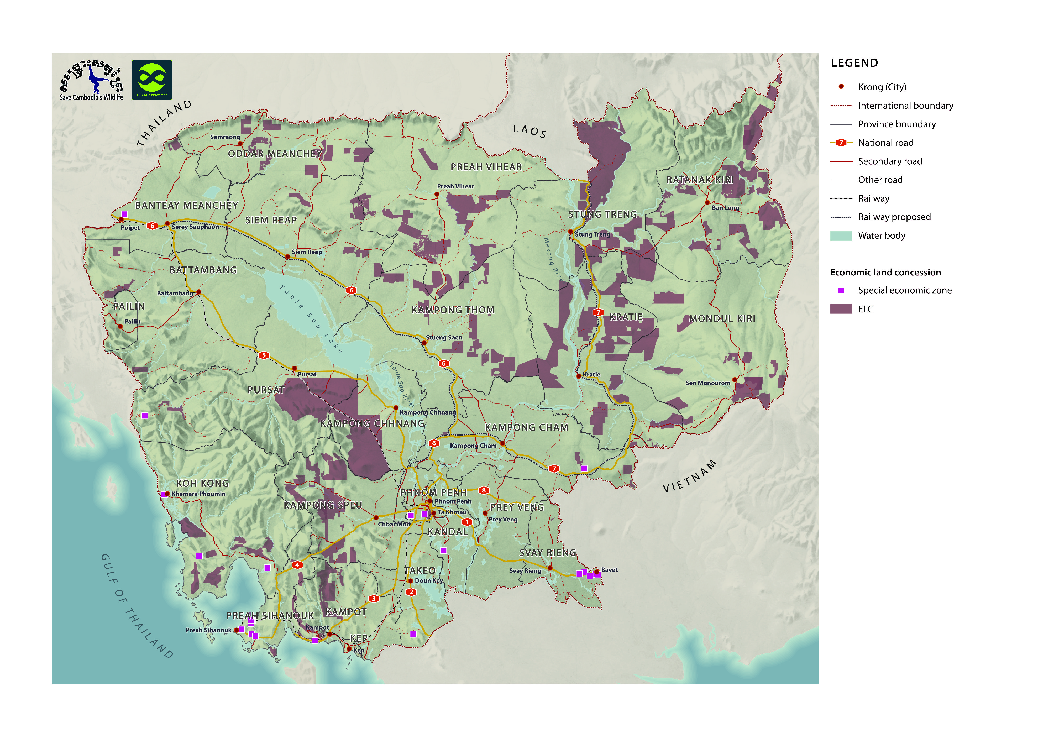
ELC and SEZ and Roads
Published by: Open Development Cambodia
Data Resources (1)
Data Resource Preview - ELC and SEZ and Roads
Additional Info
| Field | Value |
|---|---|
| Dataset topic category |
|
| Language |
|
| Dataset reference date | February 4, 2013 |
| Temporal extent's start date | December 6, 2015 |
| Temporal extent's end date | December 6, 2015 |
| GeoNames |
|
| Process Step | Data were provided to Open Development Cambodia directly by Save Cambodia's Wildlife's 2013 Atlas Working Group in JPEG format. |
| Lineage | Save Cambodia's Wildlife. Atlas of Cambodia: maps on socio-economic development and environment. Second ed. Phnom Penh, 2014. Print. Aruna Technology Ltd 417 Sisowath Blvd, Sangkat Chaktomuk, Phnom Penh, Cambodia Land Line: +855 (0)23 215 231 Fax: +855 (0)23 215 234 Email: info.aruna@arunatechnology.com National Institute of Statistics (NIS), Ministry of Planning Cambodia, Economic Census 2011. |
| Responsible party | Save Cambodia's Wildlife (SCW) info@cambodiaswildlife.org +855 23 88 20 35 http://cambodiaswildlife.org 6Eo St. 570, Sangkat Boeung Kak 2, Khan Tuol Kork, Phnom Penh, Cambodia |
| Metadata creator information | Metadata last updated on 2015-12-06. For inquiries contact: Open Development Cambodia contact@opendevcam.net +855 23 221 164 http://www.opendevelopmentcambodia.net 43 St. 208, Sangkat Boeung Riang, Khan Daun Penh, Phnom Penh, Cambodia |
| License | CC-BY-4.0 |
| Copyright | No |
| Version | 1.0 |
| Date uploaded | December 6, 2015, 18:28 (UTC) |
| Date modified | June 13, 2018, 10:35 (UTC) |