-
Solar power plant in Cambodia
 Cambodia
August 16, 2022
Source: https://www.stimson.org/2020/mekong-infrastructure-tracker-tool/
Cambodia
August 16, 2022
Source: https://www.stimson.org/2020/mekong-infrastructure-tracker-tool/
 The dataset of a solar power plant in Cambodia is extracted from the Mekong Infrastructure Tracker Dashboard available in Cambodia. The solar power plants dataset involved the u...
-
Rainfall estimates from rain gauge and satellite observations (CHIRPS pentad dataset)
Cambodia
June 23, 2022
Source: The data is derived from...
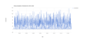 CHIRPS is an abbreviation for Climate Hazards Group InfraRed Precipitation with Station Data (Version 2.0 final). The CHIRPS is a 30+ year quasi-global rainfall dataset and inco...
-
Global Surface Water Data in Cambodia
Cambodia
February 5, 2022
Source:
 The Global Surface Water dataset from Joint Research Centre has a complete history of water detections over the 37-year period from 1984 to 2020 produced under the Copernicus Pr...
-
Collateral damage: Land loss and abuses in Cambodia’s microfinance sector
 Cambodia
Reports, journal articles, and research papers (including theses and dissertations)
Cambodian League for the Promotion and Defense of Human Rights...
2019
Collateral Damage: Land Losses and Abuses in Cambodia’s Microfinance Sector details the size and scope of Cambodia’s MFI sector and seeks to highlight the human rights abuses th...
Cambodia
Reports, journal articles, and research papers (including theses and dissertations)
Cambodian League for the Promotion and Defense of Human Rights...
2019
Collateral Damage: Land Losses and Abuses in Cambodia’s Microfinance Sector details the size and scope of Cambodia’s MFI sector and seeks to highlight the human rights abuses th...
-
Population census 2019 (Final population totals)
Cambodia
September 27, 2021
Source: Official website of National Institute of Statistics...
 This dataset provides a final result census of the population in the Kingdom of Cambodia in 2019, which shows the total population, total population of males and females, total ...
-
Population census 2019 (Provisional population totals)
Cambodia
September 27, 2021
Source: Official website of National Institute of Statistics...
 This dataset provides a provisional census of the population in the Kingdom of Cambodia in 2019, which shows the total population, total population of males and females, total h...
-
Cambodia Disaster Management Reference Handbook 2017
Cambodia
Reports, journal articles, and research papers (including theses and dissertations)
Center for Excellence in Disaster Management & Humanitarian Assistance
2017
This report focuses on country overview, disaster overview, organizational structure for disaster management, infrastructure, health, woman, peace, and security.
-
Marine fisheries management area
Cambodia
April 22, 2021
Source: Prakas No 364 on establishment of management fishery area in Koh...
 This dataset shows the Cambodia's first large-scale marine protected area in order to enhance the protection of the marine biodiversity and fisheries livelihood within Archip...
-
Canals in Cambodia (2008)
Cambodia
October 26, 2016
Source: Office for the Coordination of Humanitarian Affairs (OCHA) in Asia...
 This dataset is included geographical locations of canals and types of canal such as earthen, levee and masonry. The data is released by Department of Geography of Ministry of L...
-
Cropland in Cambodia
Cambodia
August 2, 2019
Source: Downloaded from WFPGeoNode:...
 This dataset contains information of cropland and location of croplands in Cambodia which was downloaded from World Food Programme GeoNode (WFPGeoNode) using data in 2013 from ...
-
Pesticide trade in Cambodia
Cambodia
December 16, 2020
Source: http://www.fao.org/faostat/en/#data/RT
This dataset contains record information of the quantity and value of pesticide trade in Cambodia: import quantity 1996-2016, import value 1961-2016, and export quantity and val...
-
Land cover in Cambodia (2012- 2016)
Cambodia
December 15, 2020
Source: Regional Land Cover Monitoring System...
 The land cover is extracted from the Regional Land Cover Monitoring System (https://rlcms-servir.adpc.net/en/landcover/) which is developed by SERVIR-Mekong. The primitives are ...
-
Infographic of Social Land Concession Program in Cambodia
Cambodia
Guidelines, instruction manuals, handbooks
Open Development Cambodia and the Office of the High Commissioner...
2019
This Social Land Concession infographic was coproduced by Open Development Cambodia (ODC) and the Office of the High Commissioner for Human Rights (OHCHR) in Cambodia, funded by...
-
Flood-prone areas
Cambodia, Mekong
October 16, 2020
Source: http://surface-water-servir.adpc.net/
This dataset shows the flood-prone areas in Cambodia and other Mekong countries from Surface Water Mapping Tool which is an application allows for calculation using a sophistica...
-
Families affected by climate hazards 2016
Cambodia
July 16, 2020
Source: NCSD's climate change data portal:...
 This dataset contains records of number of families affected by climate hazards comprising storm, flood and drought in 2016 at province level, which was extracted from Climate C...
-
Vulnerability to climate hazards
Cambodia
July 7, 2020
Source: NCSD's climate change data portal:...
 Vulnerability to climate hazards is implied by indicators, defined as the Vulnerability Index (VI), which corresponding to major natural hazards, categorized as drought, storm, ...
-
Mine/ERW casualties (2005- 2013)
Cambodia
June 30, 2020
Source: Office for the Coordination of Humanitarian Affairs (OCHA) in Asia...
 This dataset shows information about locations of casualties caused by explosive remnants of war (ERW) and mines from 2005 to 2013 across Cambodia. Plus, it also includes number...
-
Mine and Explosive Remnant of War (ERW) accident casualties (2016-2017)
Cambodia
June 30, 2020
Source: Monthly Report for December 2017 published by the Cambodian Mine...
 This dataset contains information, extracted from Monthly Report for December 2017 of Cambodia Mine/ERW Victim Information System (CMVIS) published by Cambodian Mine Action and...
-
Forest cover in Cambodia (1973-2014)
Cambodia
November 25, 2015
Source: U.S. Department of the Interior, United States Geological Survey...
 This dataset shows forest cover in Cambodia in 1973, 1989, 2000, 2004, 2009 and 2014. Geographic data is encoded in the WGS 84, Zone 48 North coordinate reference system. Data w...
-
Mine and Explosive Remnant of War (ERW) accident casualties (2018-2019)
Cambodia
June 23, 2020
Source: Monthly Report for March 2017 published by the Cambodian Mine...
 This dataset contains information, extracted from Monthly Report for October 2019 of Cambodia Mine/ERW Victim Information System (CMVIS) published by Cambodian Mine Action and ...