-
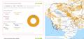
Tree cover loss by dominant driver

 Cambodia
10 tháng 4, 2026
Nguồn: Global Forest Watch:...
Cambodia
10 tháng 4, 2026
Nguồn: Global Forest Watch:...
Dữ liệu này không có mô tả
-
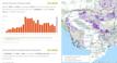
Forest-related greenhouse gas emissions in Cambodia
Cambodia
9 tháng 4, 2026
Nguồn: Global Forest Watch:...
Dữ liệu này không có mô tả
-
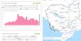
Plantations in Cambodia by provincial level
Cambodia
8 tháng 4, 2026
Nguồn: Global Forest Watch:...

Dữ liệu này không có mô tả
-
Tree cover by land cover class in Cambodia 2020
Cambodia
8 tháng 4, 2026
Nguồn: Global Forest Watch: https://gfw.global/LCQlwv

Dữ liệu này không có mô tả
-
Forest cover loss from fire
Cambodia
6 tháng 4, 2026
Nguồn: Global Forest Watch:...
Dữ liệu này không có mô tả
-
Forest cover data
Cambodia
28 tháng 1, 2026
Nguồn: Global Forest Watch:...

Dữ liệu này không có mô tả
-
Forest cover in Cambodia (2015-2023)
Cambodia
6 tháng 9, 2024
Nguồn: Servir SEA: https://cambodia-me-servir.adpc.net/mapviewer

Dữ liệu này không có mô tả
-
Land cover in Cambodia (2015-2023)
Cambodia
21 tháng 12, 2024
Nguồn: Servir SEA: https://cambodia-me-servir.adpc.net/mapviewer

Dữ liệu này không có mô tả
-
Lớp phủ thực vật Việt Nam 2015 - 2018
 Viet Nam
14 tháng 9, 2020
Nguồn: https://www.eorc.jaxa.jp
Bộ dữ liệu lớp phủ thực vật 2015 - 2018 tại Việt Nam là bộ dữ liệu được xử lý từ ảnh viễn thám của trung tâm vũ trụ JAXA Nhật Bản. Bộ dữ liệu đã sử dụng các bức ảnh đa thời gian...
Viet Nam
14 tháng 9, 2020
Nguồn: https://www.eorc.jaxa.jp
Bộ dữ liệu lớp phủ thực vật 2015 - 2018 tại Việt Nam là bộ dữ liệu được xử lý từ ảnh viễn thám của trung tâm vũ trụ JAXA Nhật Bản. Bộ dữ liệu đã sử dụng các bức ảnh đa thời gian...
-
Bộ dữ liệu về các loại rừng, quản lý và điều hành rừng ở Việt Nam
Viet Nam
2 tháng 11, 2022
Nguồn: http://www.terra-i.org/terra-i/data/data-terra-i_vietnam.html
Bộ dữ liệu nhằm thể hiện vị trí và thông tin các phát hiện biến động lớp phủ bề mặt đất. Dữ liệu này là kết quả dự án hợp tác giữa chương trình UN-REDD Việt Nam giai đoạn II và ...
-
Forest cover in Cambodia (2015-2018)
Cambodia
13 tháng 6, 2018
Nguồn: The forest monitoring system which is the product of collaboration...
 This forest cover is extracted from the Forest Monitoring System (https://rlcms-servir.adpc.net/en/forest-monitor/) which is developed by SERVIR-Mekong and the Global Land...
-
GISTDA Forest Monitoring System (Thailand)
 Thailand
20 tháng 3, 2021
Nguồn: GISTDA Forest Monitoring System (gfms.gistda.or.th)
Thailand
20 tháng 3, 2021
Nguồn: GISTDA Forest Monitoring System (gfms.gistda.or.th)
Dữ liệu này không có mô tả
-
Thailand Forest Cover 2020
Thailand
19 tháng 3, 2021
Nguồn: Forest Land Management Office (https://bit.ly/30ZiAhz) Royal...
Dữ liệu này không có mô tả
-
Thailand Permanent Forest
Thailand
10 tháng 2, 2021
Nguồn: GISTDA Portal (https://gistdaportal.gistda.or.th/portal/home/)
Dữ liệu này không có mô tả
-
Hansen Forest Cover Loss 2000-2019: Thailand, Vietnam, Laos, Cambodia, Myanmar
Cambodia, Lao People's Democratic Republic, Myanmar, Thailand, Viet Nam
21 tháng 1, 2021
Nguồn: Hansen, M. C., P. V. Potapov, R. Moore, M. Hancher, S. A....
Dữ liệu này không có mô tả
-
Regional Land Cover
Cambodia, Viet Nam, Lao People's Democratic Republic, Thailand, Myanmar, China
27 tháng 10, 2016
Nguồn: GlobCover 2009 (Global Land Cover Map) RELEASED ON 21st December...
The dataset contains a raster version of the GlobCover land cover map produced for the year 2009, clipped to the Greater Mekong Region. The land cover image is derived from the...
-
Hansen Forest Cover Gain 2000-2012: Thailand, Vietnam, Laos, Cambodia, Myanmar
Cambodia, China, Lao People's Democratic Republic, Myanmar, Thailand, Viet Nam
17 tháng 12, 2020
Nguồn: Hansen, M. C., P. V. Potapov, R. Moore, M. Hancher, S. A....
Forest gain during the period 2000–2012, defined as the inverse of loss, or a non-forest to forest change entirely within the study period. Encoded as either 1 (gain) or 0 (no...
-
Hansen Tree Cover 2000: Thailand, Vietnam, Laos, Cambodia, Myanmar
Cambodia, China, Lao People's Democratic Republic, Myanmar, Thailand, Viet Nam
17 tháng 12, 2020
Nguồn: Global Forest Watch / Hansen, M. C., P. V. Potapov, R. Moore, M....
A dataset visualising tree cover across the Greater Mekong Subregion at 30 x 30m resolution. For the purpose of this study, “tree cover” was defined as all vegetation taller...
-
Land cover in Cambodia (2012- 2016)
Cambodia
15 tháng 12, 2020
Nguồn: Regional Land Cover Monitoring System...
 The land cover is extracted from the Regional Land Cover Monitoring System (https://rlcms-servir.adpc.net/en/landcover/) which is developed by SERVIR-Mekong. The primitives are...
-
Phủ bề mặt Việt Nam 2009
Viet Nam
31 tháng 8, 2020
Nguồn: http://due.esrin.esa.int/page_globcover.php
Dữ liệu phủ bề mặt được xây dựng từ ảnh viễn thám Envisat Meris có độ phân giải là 300m năm 2009.
You can also access this registry using the Giao diện lập trình ứng dụng (see Văn bản API).