-
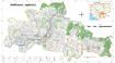
Siem Reap communal land use planning (CLUP) atlas 2009
 Cambodia
April 18, 2017
Source: Ministry of Land Management, Urban Planning and Construction...
Cambodia
April 18, 2017
Source: Ministry of Land Management, Urban Planning and Construction...
 Siem Reap communal land use planning(CLUP) atlas (Chan Sar, Doun Peaeng, Leang Dai, Nokor Pheas , Popel, Srae Khvav, Svay Chek, Tayaek commune) is communal land use planning ext...
-
Kampong Cham communal land use planning (CLUP) atlas 2009
Cambodia
April 18, 2017
Source: Ministry of Land Management, Urban Planning and Construction...
 Kampong Cham communal land use planning(CLUP) atlas (Chikor, Moung Riev, Roang, and Srak commune) is communal land use planning extracted from 2009 contained both detailed curre...
-
Mondulkiri communal land use planning (CLUP) atlas 2009
Cambodia
April 18, 2017
Source: Ministry of Land Management, Urban Planning and Construction...
 Mondulkiri communal land use planning(CLUP) atlas (Dak Dam, Pu Chri, Saen Monourom, Srae Ampum, Srae Khtum, and Srae Preah commune) is communal land use planning extracted from ...
-
Kratie communal land use planning (CLUP) atlas 2009
Cambodia
April 18, 2017
Source: Ministry of Land Management, Urban Planning and Construction...
 Kratie communal land use planning(CLUP) atlas (Dar, Kbal Damrey, O Krieng, Ruessei Kaev, Saob, Srae Char, Svay Chreah, and Thmi commune) is communal land use planning extracted ...
-
Commercial scale community bamboo harvesting factsheet
Lao People's Democratic Republic
Case studies
ForInfo, RECOFTC
2013
 This case study provides accounts of ForInfo's work in Bokeo province, Lao PDR, to regenerate forests harmed by shifting cultivation and forest fires, and to bolster sustainable...
-
Agriculture and forestry research strategy to cope climate risk
Lao People's Democratic Republic
Reports, journal articles, and research papers (including theses and dissertations)
Vanthong Phengvichith, NAFRI
2015
 Smallholder-based production with low productivity; minimal farmer experience with modern agriculture technologies and marketing, Post-harvest loss still high and lack of value-...
-
Great expectations: Chinese tree plantation concessions in the Lao PDR
Lao People's Democratic Republic
Conference/workshop proceedings and presentations
Juliet Lu, Centre for Development and Environment,
2014
 A presentation of research findings regarding Chinese tree plantation concessions in the Lao PDR
-
Lao land concessions, development for the people?
Lao People's Democratic Republic
Reports, journal articles, and research papers (including theses and dissertations)
Cor. H. Hanssen
2007
 This paper aims to provide policy makers with an analysis of information recently gathered in Laos concerning land concessions, hoping to assist them in their decision making.
-
Land information coordination strategy
Lao People's Democratic Republic
Reports, journal articles, and research papers (including theses and dissertations)
Don Grant, National Land Management Authority
2006
 A report examining the availability of land and spatial information across Laos, the implications for land rights, and recommendations to improve upon the current situation.
-
Communal land titling for securing sustainable bamboo value chains
Lao People's Democratic Republic
Conference/workshop proceedings and presentations
JF Kibler, LIWG
2014
 This presentation is about a communal land titling project in Huaphanh province and covers the background of the project, expected benefits, challenges, and plans for the future...
-
Field study: Nam Et and Phou Loei national biodiversity conservation areas
Lao People's Democratic Republic
Reports, journal articles, and research papers (including theses and dissertations)
 This field study investigates the economic benefits provided by two adjoiningNational Biodiversity Conservation Areas (NBCAs): Nam Et and Phou Loei (NEPL).
-
Resource development and the perpetuation of poverty in rural Laos
Lao People's Democratic Republic
Reports, journal articles, and research papers (including theses and dissertations)
Routledge, Yayoi Fujita Lagerqvist, Laura Woollacott, Avakat...
2014
 Government efforts to industrialise and modernise the Lao economy through intensive resource development are having adverse effects on rural livelihoods as resources are degrade...
-
Cultivating and collecting cardamom (Amomum spp) and other NTFP's Muang Long District, Luang Namtha Province, Lao PDR 2001
Lao People's Democratic Republic
Reports, journal articles, and research papers (including theses and dissertations)
Trond Kvitvik
2001
 Cardamom (Amomum villosum) collection and cultivation is important for the local economies in Muang Long area, Luang Namtha Province, but is also an important export product for...
-
Laos: Planting for the future
Lao People's Democratic Republic
Reports, journal articles, and research papers (including theses and dissertations)
Sean Foley
2009
 The annexes of a report commissioned by the Lao Land Issues Working Group to map the principles and process for preparing an environmental and social Code of Practice (CoP) for ...
-
LUP coordination workshop in Huaphan Province report
Lao People's Democratic Republic
Reports, journal articles, and research papers (including theses and dissertations)
Foppes, J.; Castella, J.C.; Melki, S.; Kibler, J.F.
2012
 The Province of Huaphan is implementing Land Use Planning (LUP) as a way to achieve national development goals such as reduction of rural poverty, investment in land and reducti...
-
Integrated spatial planning for sustainable development
Lao People's Democratic Republic
Reports, journal articles, and research papers (including theses and dissertations)
Mr. Jensen.P.G, Mr. Singkavongxay.S, Water Resources and...
2007
 The Guideline is prepared to support training of government officials in the development and use of spatial planning as an instrument towards sustainable development and better ...
-
Minutes of the SWGAB government/development partners sub-sector working group on farmer & agribusiness
Lao People's Democratic Republic
Conference/workshop proceedings and presentations
SWGAB / LEAP
2014
 Minutes of the SWGAB Government/Development Partners Sub-Sector Working Group on Farmer & Agribusiness meeting on 16th September 2013. This document includes happenings and deci...
-
The participatory water resources protection role creating
 Lao People's Democratic Republic
Guidelines, instruction manuals, handbooks
Eric Meusch, Roger Mollot , WWF
2009
Lao People's Democratic Republic
Guidelines, instruction manuals, handbooks
Eric Meusch, Roger Mollot , WWF
2009
 The participatory protection is mean planning creation base on their experiences and local understanding to water resources participatory protection planning, The processing wil...
-
Remark by UN RC, UNDP RR at the closing session of the RTIM 2104
Lao People's Democratic Republic
Reports, journal articles, and research papers (including theses and dissertations)
2014
 Remarks by the UN Resident Coordinator and UNDP at a Round Table meeting with the Ministry of Planning and Investment in 2014. Includes notes on MDGs, governance, economic devel...
-
Procedures and methods for land use planning and land allocation
Lao People's Democratic Republic
Guidelines, instruction manuals, handbooks
Thongphath Leuangkhamma, Somsak Sysomvang and Peter Jones
2001
 This technical booklet aims to summarise the procedures, methods and practices for participatory land use planning and land allocation (LUP/LA) as tested and practised in target...