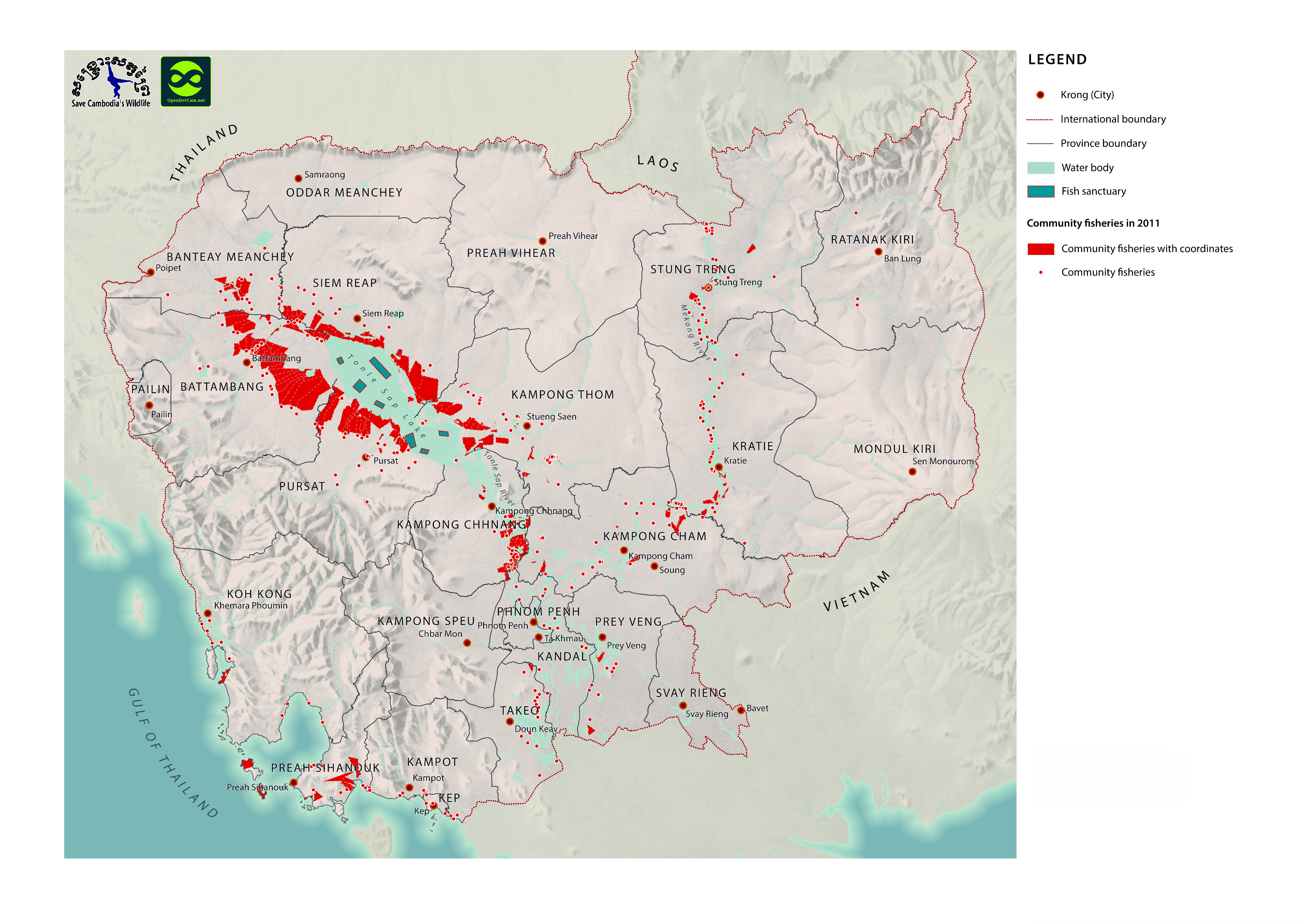
Fish sanctuaries
Published by: Open Development Cambodia
Data Resources (7)
Data Resource Preview - Fish sanctuaries
Additional Info
| Field | Value |
|---|---|
| Dataset topic category | Agriculture and fishing |
| Language |
|
| Use limitations | By accessing this website or database, users agree to take full responsibility for reliance on any site information provided and to hold harmless and waive any and all liability against individuals or entities associated with its development, form and content for any loss, harm or damage suffered as a result of its use. |
| Dataset reference date | February 4, 2013 |
| GeoNames |
|
| West bounding coordinates | 103.73915551014439 |
| East bounding coordinates | 106.08865199840355 |
| South bounding coordinates | 10.743621852864507 |
| North bounding coordinates | 13.936903035729438 |
| Spatial Reference System | WGS 84 / UTM zone 48N (EPSG:32648) |
| Process Step | Data were provided to Open Development Cambodia directly by Save Cambodia's Wildlife's 2013 Atlas Working Group in JPEG format. |
| Lineage | Save Cambodia's Wildlife. Atlas of Cambodia: maps on socio-economic development and environment. Second ed. Phnom Penh, 2014. Print. |
| Responsible party | Save Cambodia's Wildlife (SCW) info@cambodiaswildlife.org +855 23 88 20 35 http://cambodiaswildlife.org 6Eo St. 570, Sangkat Boeung Kak 2, Khan Tuol Kork, Phnom Penh, Cambodia |
| Metadata creator information | Metadata last updated on 2015-12-06. For inquiries contact: Open Development Cambodia contact@opendevcam.net +855 23 221 164 http://www.opendevelopmentcambodia.net 43 St. 208, Sangkat Boeung Riang, Khan Daun Penh, Phnom Penh, Cambodia |
| License | CC-BY-3.0-IGO |
| Copyright | To be determined |
| Version | 1.0 |
| Date uploaded | February 8, 2017, 07:29 (UTC) |
| Date modified | January 21, 2020, 10:04 (UTC) |