-
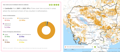
Tree cover by land cover class in Cambodia 2020

 ကမ္ဘောဒီးယား
2026၊ 11 ဇွန်
ရင်းမြစ်: Global Forest Watch: https://gfw.global/LCQlwv
ကမ္ဘောဒီးယား
2026၊ 11 ဇွန်
ရင်းမြစ်: Global Forest Watch: https://gfw.global/LCQlwv

dataset တွင် မည်သည့်ဖော်ပြမှုမှ မပါရှပါ
-
Plantations in Cambodia by provincial level
ကမ္ဘောဒီးယား
2026၊ 11 ဇွန်
ရင်းမြစ်: Global Forest Watch:...

dataset တွင် မည်သည့်ဖော်ပြမှုမှ မပါရှပါ
-
Forest cover loss from fire
ကမ္ဘောဒီးယား
2026၊ 11 ဇွန်
ရင်းမြစ်: Global Forest Watch:...

dataset တွင် မည်သည့်ဖော်ပြမှုမှ မပါရှပါ
-
Forest cover data
ကမ္ဘောဒီးယား
2026၊ 11 ဇွန်
ရင်းမြစ်: Global Forest Watch:...

dataset တွင် မည်သည့်ဖော်ပြမှုမှ မပါရှပါ
-
Tree cover loss by dominant driver
ကမ္ဘောဒီးယား
2026၊ 11 ဇွန်
ရင်းမြစ်: Global Forest Watch:...
dataset တွင် မည်သည့်ဖော်ပြမှုမှ မပါရှပါ
-
Forest-related greenhouse gas emissions in Cambodia
ကမ္ဘောဒီးယား
2026၊ 11 ဇွန်
ရင်းမြစ်: Global Forest Watch:...

dataset တွင် မည်သည့်ဖော်ပြမှုမှ မပါရှပါ
-
Land title of the Prov indigenous communal land for land parcel number 116
ကမ္ဘောဒီးယား
Profiles - Geographical areas and sites
Ministry of Land Management, Urban Planning and Construction
2025
Ratanakiri Provincial Administration, through the Provincial Department of Land Management, Urban Planning, Construction and Cadastral, registered the Prov indigenous communal...
-
Land title of the Prov indigenous communal land for land parcel number 114
ကမ္ဘောဒီးယား
Profiles - Geographical areas and sites
Ministry of Land Management, Urban Planning and Construction
2025
Ratanakiri Provincial Administration, through the Provincial Department of Land Management, Urban Planning, Construction and Cadastral, registered the Prov indigenous communal...
-
Land title of the Prov indigenous communal land for land parcel number 099
ကမ္ဘောဒီးယား
Profiles - Geographical areas and sites
Ministry of Land Management, Urban Planning and Construction
2025
Ratanakiri Provincial Administration, through the Provincial Department of Land Management, Urban Planning, Construction and Cadastral, registered the Prov indigenous communal...
-
Fisheries resource management data
ကမ္ဘောဒီးယား
2025၊ 27 မေ
ရင်းမြစ်: Prakas No.628 on 26.12. 2011 Prakas No.123 on14.03.2011 Prakas...

dataset တွင် မည်သည့်ဖော်ပြမှုမှ မပါရှပါ
-
Announcement no. 4958 on progress of the construction and the provision of 5G mobile service in Cambodia
ကမ္ဘောဒီးယား
4958
သတိပေးချက်
2026၊ 9 ဇွန်
This announcement shows the progress of the construction of the 5th generation (5G) mobile network and mobile service in Cambodia, with operators adding 5G antenna stations in...
-
Fifth-Generation (5G) mobile service operation in Cambodia
ကမ္ဘောဒီးယား
2026၊ 6 ဖေဖော်ဝါရီ
ရင်းမြစ်: Ministry of Post and Telecommunications,...
dataset တွင် မည်သည့်ဖော်ပြမှုမှ မပါရှပါ
-
Management plan for coastal area of Chroy Svay commune fishery
ကမ္ဘောဒီးယား
Reports, journal articles, and research papers (including theses and dissertations)
Fisheries Administration
This community fishery management plan outlines the general situation, demographics, and socio-economic status of the community fishery, resources available in community...
-
Land title of the Prov indigenous communal land for land parcel number 097
ကမ္ဘောဒီးယား
Profiles - Geographical areas and sites
Ministry of Land Management Urban Planning and Construction
2025
Ratanakiri Provincial Administration, through the Provincial Department of Land Management, Urban Planning, Construction and Cadastral, registered the Prov indigenous communal...
-
Land title of the Prov indigenous communal land for land parcel number 098
ကမ္ဘောဒီးယား
Profiles - Geographical areas and sites
Ministry of Land Management Urban Planning and Construction
2025
Ratanakiri Provincial Administration, through the Provincial Department of Land Management, Urban Planning, Construction and Cadastral, registered the Prov indigenous communal...
-
Land title of the Prov indigenous communal land for land parcel number 100
ကမ္ဘောဒီးယား
Profiles - Geographical areas and sites
Ministry of Land Management, Urban Planning and Construction
2025
Ratanakiri Provincial Administration, through the Provincial Department of Land Management, Urban Planning, Construction and Cadastral, registered the Prov indigenous communal...
-
Community protected areas
ကမ္ဘောဒီးယား
2026၊ 4 မေ
ရင်းမြစ်: Royal Gazette from government of Cambodia, Sub-decree and Prakas,...

dataset တွင် မည်သည့်ဖော်ပြမှုမှ မပါရှပါ
-
Sub-decree No. 02 on community determination in Kulen Promtep Wildlife Sanctuary with 5000 hectares of land in Yeang commune and Kantuot commune, Choam Ksant district, Preah Vihear province
ကမ္ဘောဒီးယား
02
Sub-decree
2016၊ 6 ဇန်နဝါရီ
This Sub-decree aims to identify a community in Kulen Promtep Wildlife Sanctuary which consists of 5000 hectares of land in Thomacheat Samdach Te Chhor Hun Sen village, Yeang...
-
Notification no. 1856 on retail fuel prices at stations for implementation from 02 June 2026
ကမ္ဘောဒီးယား
1856
သတိပေးချက်
2026၊ 2 ဇွန်
This notification no.1753 aims to display the fuel price list at stations from May 27, 2026, which includes: 1. Discount of 6.5 cents/liter with the aim of facilitating the...
-
Sub-decree no. 36 on reclassification and donation of state property
ကမ္ဘောဒီးယား
36
Sub-decree
2026၊ 9 မတ်
This sub-decree shows the reclassification of 872 (eight hundred and seventy-two) square meters of land belonging to the Kep Provincial Department of Tourism from state public...