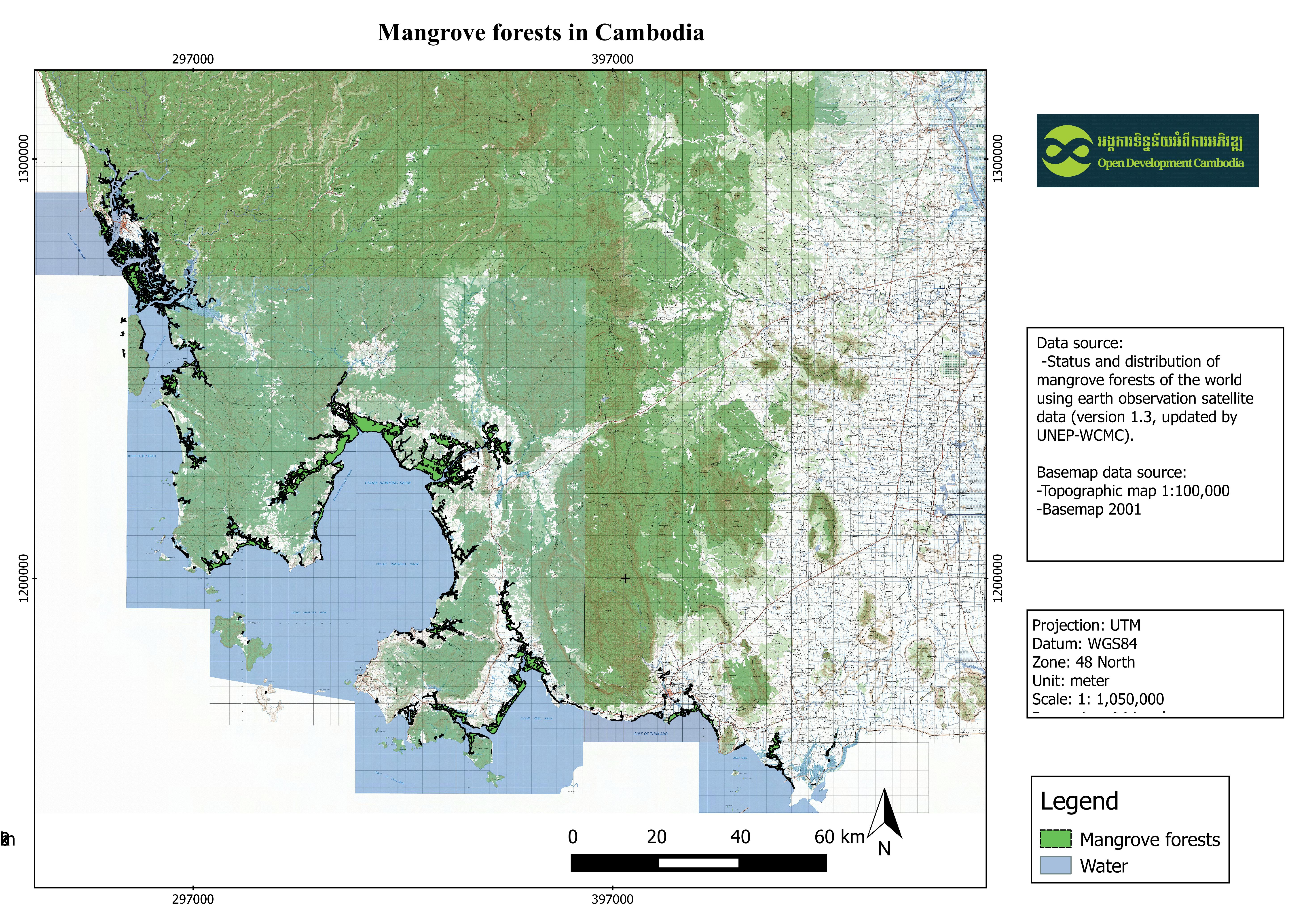
Distribution of mangrove forests in Cambodia
พิมพ์โดย: Open Development Cambodia
ทรัพยากรข้อมูล (7)
ตัวอย่างทรัพยากรข้อมูล - Distribution of mangrove forests in Cambodia
ข้อมูลเพิ่มเติม
| ฟิลด์ | ค่า |
|---|---|
| หมวดหมู่หัวข้อของชุดข้อมูล | Environment and natural resources |
| ภาษา |
|
| ข้อจำกัดการใช้งาน | Dataset is restricted by the user constraints as outlined by UNEP-WCMC General Data License, http://www.unep-wcmc.org/policies/general-data-license-excluding-wdpa%20-%20data_policy. |
| วันที่ชุดข้อมูล | 4 กรกฎาคม ค.ศ. 2011 |
| ชื่อทางภูมิศาสตร์ |
|
| พิกัดขอบเขตทิศตะวันตก | 102.914924621582 |
| พิกัดขอบเขตทิศตะวันออก | 104.547203063965 |
| พิกัดขอบเขตทิศใต้ | 10.4023275375366 |
| พิกัดขอบเขตทิศเหนือ | 11.7796010971069 |
| ระบบอ้างอิงเชิงพื้นที่ | WGS 84 (EPSG:4326) (CRS:84) |
| ขั้นตอนของกระบวนการ | This dataset shows the distribution of mangrove forests, derived from earth observation satellite imagery for the Greater Mekong Subregion. Then it was clip by cambodia region by QGIS application. |
| แหล่งที่มา | Giri C, Ochieng E, Tieszen LL, Zhu Z, Singh A, Loveland T, Masek J, Duke N (2011). Status and distribution of mangrove forests of the world using earth observation satellite data (version 1.3, updated by UNEP-WCMC).Global Ecology and Biogeography 20: 154-159 ; http://data.unep-wcmc.org/datasets/4 |
| ฝ่ายงานรับผิดชอบ | UNEP World Conservation Monitoring Centre Address: #219 Huntingdon Road, Cambridge, CB3 0DL, United Kingdom Contact: +44 (0)1223 277314 |
| ข้อมูลผู้สร้างคำอธิบายชุดข้อมูล | Metadata last updated on 2016-08-03. For inquiries contact: Open Development Cambodia Address: #43 St. 208, Phnom Penh, Cambodia. Email: contact@opendevcam.net Website: http://www.opendevcam.net |
| คุณสมบัติ | AREA_KM2: Areas in square kilometer; AREA_M2: Areas in square meter |
| สัญญาอนุญาต | CC-BY-4.0 |
| ลิขสิทธิ์ | Yes |
| เวอร์ชัน | 1.3 |
| วันที่อัพโหลด | สิงหาคม 2, 2016, 07:11 (UTC) |
| แก้ไขเมื่อ | มิถุนายน 28, 2023, 01:48 (UTC) |