Hydropower Dams in Myanmar 2017
พิมพ์โดย: Open Development Myanmar
ทรัพยากรข้อมูล (7)
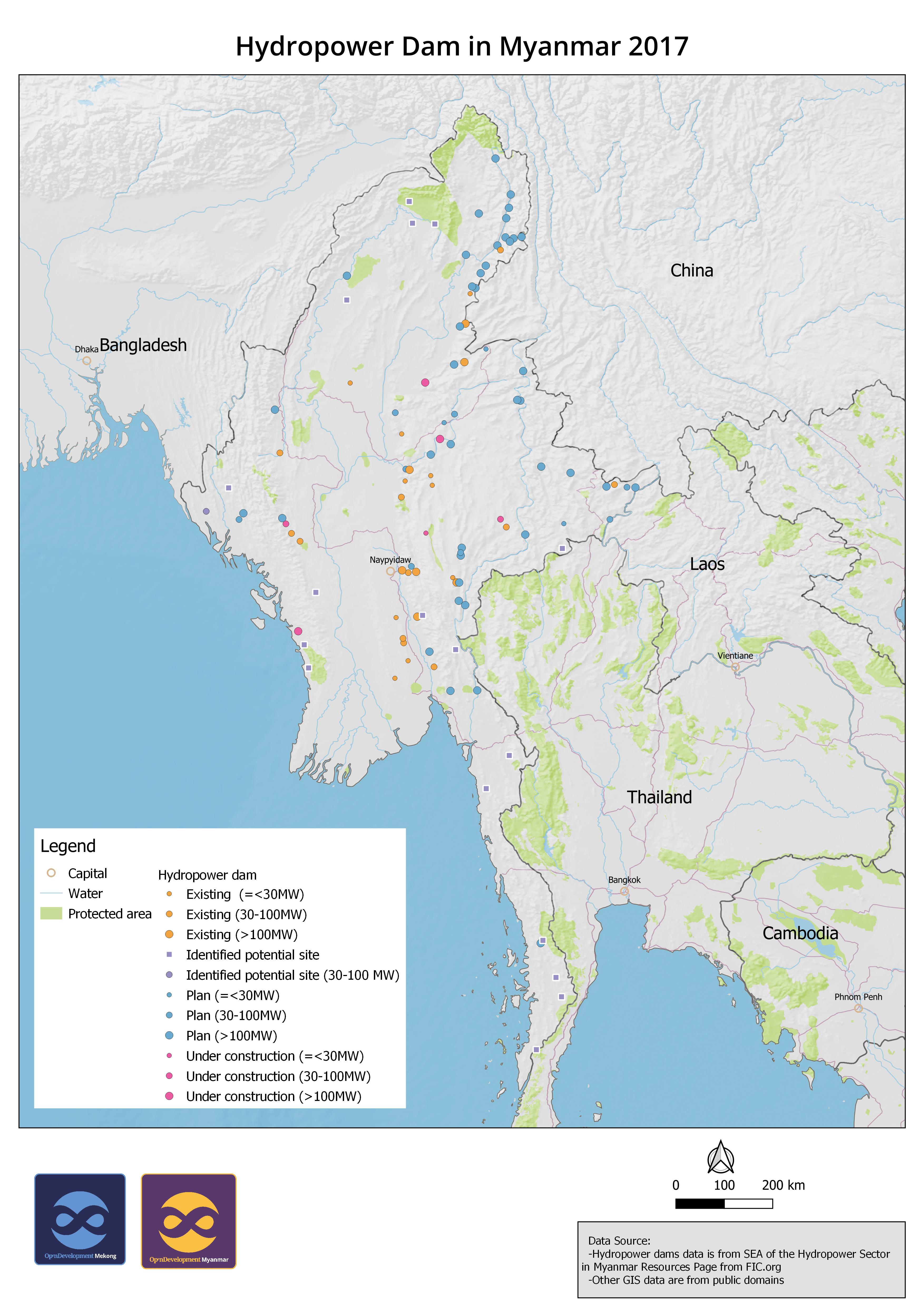
ตัวอย่างทรัพยากรข้อมูล - [English] Hydropower Dam in Myanmar 2017
ข้อมูลเพิ่มเติม
| ฟิลด์ | ค่า |
|---|---|
| ภาษา |
|
| ข้อจำกัดการใช้งาน | There is no information about use limitation. |
| วันที่ชุดข้อมูล | 1 มกราคม ค.ศ. 2017 |
| วันสุดท้ายของขอบเขตชั่วคราว | 1 มกราคม ค.ศ. 2017 |
| ชื่อทางภูมิศาสตร์ |
|
| พิกัดขอบเขตทิศตะวันตก | 92.6521835327148 |
| พิกัดขอบเขตทิศตะวันออก | 100.720932006836 |
| พิกัดขอบเขตทิศใต้ | 10.7752084732056 |
| พิกัดขอบเขตทิศเหนือ | 27.5259418487549 |
| ระบบอ้างอิงเชิงพื้นที่ | WGS 84 (EPSG:4326) (CRS:84) |
| ความแม่นยำเชิงตำแหน่ง | There is no information about positional accuracy. |
| ความสมบูรณ์ | There is no information about completeness. |
| ขั้นตอนของกระบวนการ | The original data was downloaded and cleaned for producing geospatial data. The records with abbreviation were added with full words from publication. Then the data was converted to SQLite for uploading to GeoServer for visualization. |
| แหล่งที่มา | International Finance Corporation (https://www.ifc.org/wps/wcm/connect/industry_ext_content/ifc_external_corporate_site/hydro+advisory/resources/sea+of+the+hydropower+sector+in+myanmar+resources+page) |
| สัญญาอนุญาต | Creative Commons Attribution Share-Alike |
| ลิขสิทธิ์ | Yes |
| เวอร์ชัน | 1.0 |
| คำสำคัญ | hydropower myanmar |
| วันที่อัพโหลด | ตุลาคม 20, 2020, 00:38 (UTC) |
| แก้ไขเมื่อ | พฤศจิกายน 11, 2020, 03:03 (UTC) |