Phnom Penh urban sprawl timeline (2003-2013)
พิมพ์โดย: Open Development Cambodia
ทรัพยากรข้อมูล (2)
ตัวอย่างทรัพยากรข้อมูล - Phnom Penh urban sprawl timeline (2003)
ข้อมูลเพิ่มเติม
| ฟิลด์ | ค่า |
|---|---|
| หมวดหมู่หัวข้อของชุดข้อมูล |
|
| ภาษา |
|
| วันที่ชุดข้อมูล | 19 มิถุนายน ค.ศ. 2014 |
| วันที่เริ่มใช้ขอบเขตชั่วคราว | 6 ธันวาคม ค.ศ. 2015 |
| วันสุดท้ายของขอบเขตชั่วคราว | 6 ธันวาคม ค.ศ. 2015 |
| ชื่อทางภูมิศาสตร์ |
|
| ความแม่นยำเชิงตำแหน่ง | There are no known issues with accuracy. |
| ความสอดคล้องเชิงตรรกะ | There are no known issues with logical consistency. |
| ความสมบูรณ์ | The data is complete. |
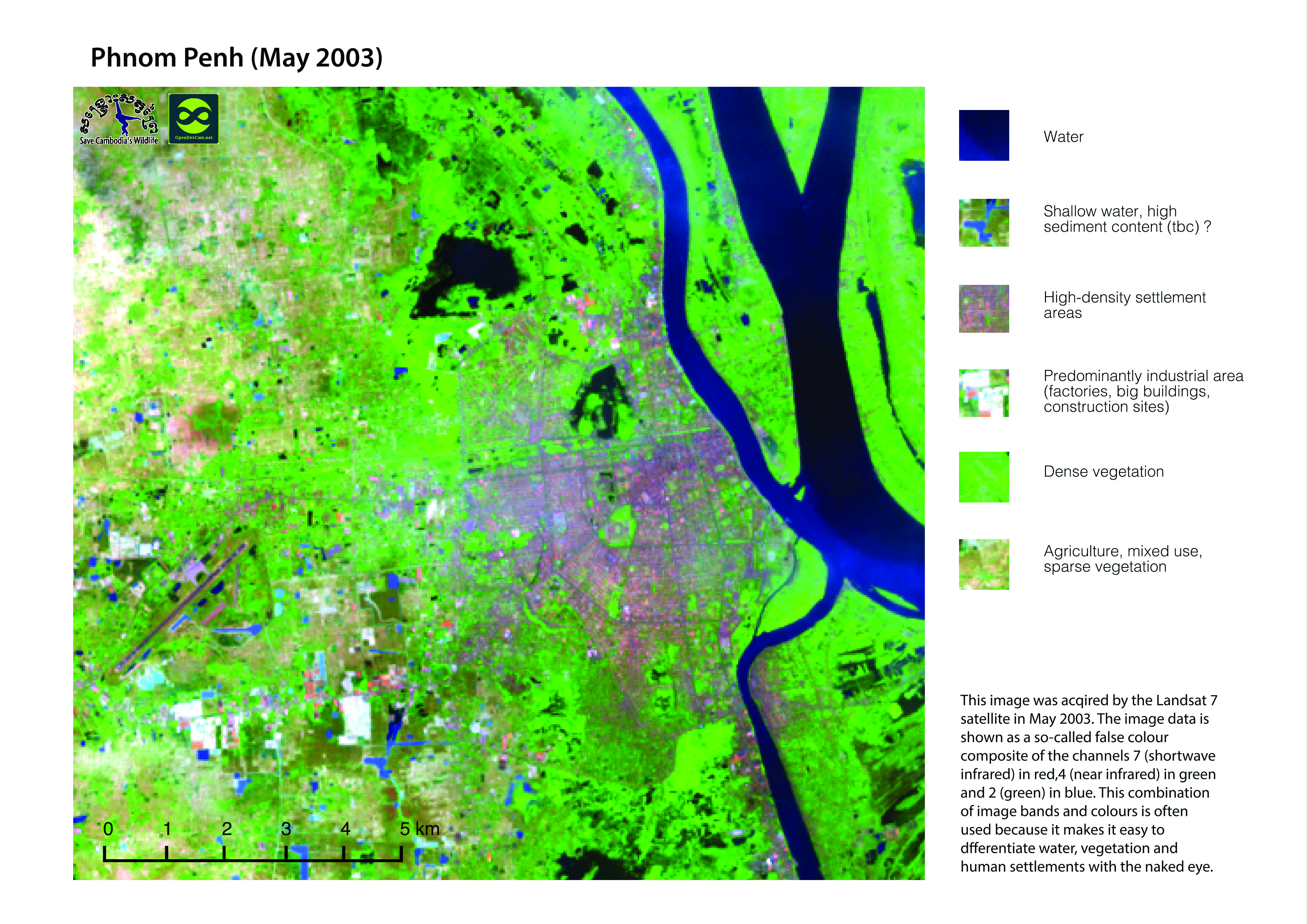
| ขั้นตอนของกระบวนการ | Images from satellite Landsat 7 (2003) and Landsat 8 (2013) are presented using false colour composite channels 7 in red (shortwave infrared), 5 in green (near infrared), 3 in blue (green). The combination of image bands and colour allow easy distinction between water, vegetation and urban areas. Images were provided to Open Development Cambodia directly by Save Cambodia's Wildlife's 2013 Atlas Working Group in JPEG format. |
| แหล่งที่มา | Landsat NASA 2003/13 http://landsat.gsfc.nasa.gov/ |
| ฝ่ายงานรับผิดชอบ | Save Cambodia's Wildlife (SCW), info@cambodiaswildlife.org, +855 23 88 20 35, http://cambodiaswildlife.org, 6Eo St. 570, Sangkat Boeung Kak 2, Khan Tuol Kork, Phnom Penh, Cambodia. |
| ข้อมูลผู้สร้างคำอธิบายชุดข้อมูล | Metadata last updated on 2015-12-06. For inquiries contact: Open Development Cambodia, contact@opendevcam.net, +855 23 221 164, http://www.opendevelopmentcambodia.net, 43 St. 208, Sangkat Boeung Riang, Khan Daun Penh, Phnom Penh, Cambodia. |
| สัญญาอนุญาต | CC-BY-4.0 |
| ลิขสิทธิ์ | No |
| เวอร์ชัน | 1.0 |
| วันที่อัพโหลด | ธันวาคม 6, 2015, 23:41 (UTC) |
| แก้ไขเมื่อ | มิถุนายน 12, 2018, 07:36 (UTC) |