Self-identification of indigenous community
พิมพ์โดย: Open Development Cambodia
ทรัพยากรข้อมูล (7)
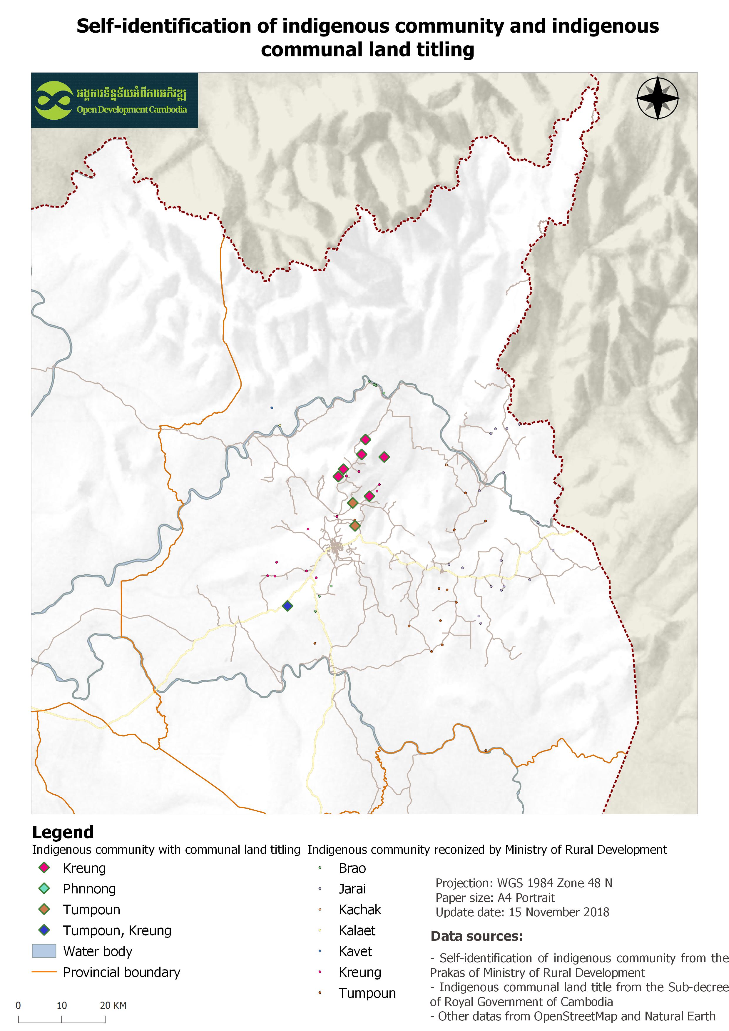
ตัวอย่างทรัพยากรข้อมูล - Self-identification of indigenous community
ข้อมูลเพิ่มเติม
| ฟิลด์ | ค่า |
|---|---|
| หมวดหมู่หัวข้อของชุดข้อมูล |
|
| ภาษา |
|
| ข้อจำกัดการใช้งาน | By accessing this website or database, users agree to take full responsibility for reliance on any site information provided and to hold harmless and waive any and all liability against individuals or entities associated with its development, form and content for any loss, harm or damage suffered as a result of its use. |
| วันที่ชุดข้อมูล | 3 ตุลาคม ค.ศ. 2018 |
| ชื่อทางภูมิศาสตร์ |
|
| พิกัดขอบเขตทิศตะวันตก | 106.84000035848292 |
| พิกัดขอบเขตทิศตะวันออก | 107.4545000769029 |
| พิกัดขอบเขตทิศใต้ | 13.310373853700602 |
| พิกัดขอบเขตทิศเหนือ | 14.08366609422535 |
| ระบบอ้างอิงเชิงพื้นที่ | WGS 84 / UTM zone 48N (EPSG:32648) |
| ความแม่นยำเชิงตำแหน่ง | The points are only for the represented location in village level. |
| ความสอดคล้องเชิงตรรกะ | There is no information about logical consistency. |
| ความสมบูรณ์ | The raw data was contributed by the NGO network to ODC, and there is no information about the completeness. |
| ขั้นตอนของกระบวนการ | The documents on self-identification of the indigenous community were scanned and digitalized to a spreadsheet. Then ODC team spatially join the spreadsheet to the village dataset to produce the spatial representation and create Shapefile. After that, the result was converted to various formats including, CSV, KML, GeoJSON and JPEG. |
| แหล่งที่มา | Letters on the recognition of indigenous community issued by the Ministry of Rural Development |
| ฝ่ายงานรับผิดชอบ | Ministry of Rural Development Address: Street No. 169, Russian Blvd., Phnom Penh, Cambodia. Tel: (+855)23 884 639, Fax: (+855)23 991 117, E-mail: Info@mrd.gov.kh, Website: www.mrd.gov.kh |
| ข้อมูลผู้สร้างคำอธิบายชุดข้อมูล | Metadata last updated on 2018-09-21. For inquiries contact: Open Development Cambodia (ODC), Email: contact@opendevcam.net, Website: http://www.opendevcam.net, Address: 43 St. 208, Phnom Penh, Cambodia. |
| สัญญาอนุญาต | CC-BY-SA-4.0 |
| ลิขสิทธิ์ | Yes |
| เวอร์ชัน | 1.0 |
| จังหวัด |
|
| คำสำคัญ | IP,Self-identification,communal land registration |
| วันที่อัพโหลด | ตุลาคม 2, 2018, 02:27 (UTC) |
| แก้ไขเมื่อ | กรกฎาคม 14, 2020, 09:47 (UTC) |