-
Reflections on energy and ecology: community participation in development
 กัมพูชา
Reports, journal articles, and research papers (including theses and dissertations)
Heinrich Böll Stiftung Cambodia
2023
This magazine comprises seven articles that address various topics in the field of environment and ecology.
กัมพูชา
Reports, journal articles, and research papers (including theses and dissertations)
Heinrich Böll Stiftung Cambodia
2023
This magazine comprises seven articles that address various topics in the field of environment and ecology.
-
Circular strategy on environment 2023-2028
 กัมพูชา
Issue and policy briefs
Ministry of Environment
The circular strategy on environment was developed in accordance with the political program of the Royal Government, the 7th legislature of the National Assembly, and the...
กัมพูชา
Issue and policy briefs
Ministry of Environment
The circular strategy on environment was developed in accordance with the political program of the Royal Government, the 7th legislature of the National Assembly, and the...
-
Reclassifying natural protected areas in Cambodia
กัมพูชา
7 กันยายน ค.ศ. 2023
แหล่งข้อมูล: Royal Gazette from government of Cambodia, Sub-decree

ชุดข้อมูลไม่มีคำอธิบาย
-
Guidelines for transboundary environmental impact assessment in the Lower Mekong River Basin
กัมพูชา
Guidelines, instruction manuals, handbooks
Mekong River Commission
2023
The guidelines for transboundary environmental impact assessment in the Lower Mekong River Basin (TbEIA) is designed as a flexible document with the perspective of its further...
-
Pentagonal strategy-phase I for growth, employment, equity, efficiency, and sustainability: Building the foundation towards realizing the Cambodia vision 2050
กัมพูชา
Issue and policy briefs
Royal Government of Cambodia
2023
Pentagonal strategy-phase I has five mottos, five strategic objectives, and five key priorities. The five mottos, namely growth, employment, equity, efficiency, and...
-
Political platform of the Royal Government of Cambodia of the seventh legislature of the national assembly for national building and defense 2023-2028
กัมพูชา
Issue and policy briefs
Royal Government of Cambodia
2023
This “Political Platform” has set five strategic objectives, five priority policies, 18 sectoral policies, and six priority policy programs to be implemented from 2023. All of...
-
Oil and gas blocks in Cambodia (2007-2020)
กัมพูชา
7 พฤษภาคม ค.ศ. 2021
แหล่งข้อมูล: Cambodian National Petroleum Authority. Exploration and...
 This dataset describes the information of oil and gas in Cambodia from 2007 to 2020. The data was collected from many sources by ODC’s mappers such as government and NGO agency...
-
Case study: Communities at the core of protected area management
กัมพูชา
Case studies
Jean-Christophe Diepart and Oeur Il
2023
This case study presents the lessons from three experiences of customary tenure documentation in protected areas in the Cambodian provinces of Preah Vihear, Mondul Kiri, and...
-
Distribution of mangrove forests in Cambodia
กัมพูชา
2 สิงหาคม ค.ศ. 2016
แหล่งข้อมูล: Giri C, Ochieng E, Tieszen LL, Zhu Z, Singh A, Loveland T, Masek...
 This dataset shows the distribution of mangrove forests, derived from earth observation satellite imagery for the Cambodia.
-
Legal analysis of forest and land laws in Cambodia
กัมพูชา
Reports, journal articles, and research papers (including theses and dissertations)
Oberndorf, R B
2006
From the foreword: "A major goal of CFI's mission in Cambodia is to support the involvement of civil society in the management of forests. Rural communities have a special role...
-
Press release on 3 indigenous communities to receive communal land titles
กัมพูชา
Reports, journal articles, and research papers (including theses and dissertations)
Three indigenous villages comprising 329 families in the northeast region of Cambodia have been granted communal land titles by the Royal Government, the first to be issued in...
-
ASTER global digital elevation model (ASTER GDEM) in Cambodia
กัมพูชา
23 กุมภาพันธ์ ค.ศ. 2023
แหล่งข้อมูล:

ชุดข้อมูลไม่มีคำอธิบาย
-
Digital Elevation Model from SRTM (Shuttle Radar Topography Mission) in Cambodia
กัมพูชา
10 กุมภาพันธ์ ค.ศ. 2023
แหล่งข้อมูล:

ชุดข้อมูลไม่มีคำอธิบาย
-
Building equity with digital tools: illuminating large-scale land acquisition and leasing for public view in Cambodia using a suite of online open-data tools
กัมพูชา
Reports, journal articles, and research papers (including theses and dissertations)
Try Thy, David Hindley
2020
Online information, data, and tools are valuable resources for people struggling to retain equity in land ownership. Digital maps are critically important in a country where...
-
Geology of Cambodia (2006)
กัมพูชา
23 กันยายน ค.ศ. 2016
แหล่งข้อมูล: Save Cambodia's Wildlife. *Atlas of Cambodia: maps on...
 This dataset provides known locations of geolocial sites in Cambodia.Geographic data is encoded in the WGS 84 coordinate reference system. Data were provided to ODC in vector...
-
Forest cover in Cambodia (2015-2018)
กัมพูชา
13 มิถุนายน ค.ศ. 2018
แหล่งข้อมูล: The forest monitoring system which is the product of collaboration...
 This forest cover is extracted from the Forest Monitoring System (https://rlcms-servir.adpc.net/en/forest-monitor/) which is developed by SERVIR-Mekong and the Global Land...
-
Classification and list of wildlife species
กัมพูชา
17 ตุลาคม ค.ศ. 2022
แหล่งข้อมูล:
ชุดข้อมูลไม่มีคำอธิบาย
-
Update on investment law in Cambodia
กัมพูชา
Analysis, discussion papers, and blogs
Darwin HEM, Chamnual MEAS
2022
Cambodia is located in Southeast Asia and it is bordered by Thailand, Laos, Vietnam, and the Gulf of Thailand, making it an ideal country for import and export operations. Amid...
-
Solar power plant in Cambodia
กัมพูชา
16 สิงหาคม ค.ศ. 2022
แหล่งข้อมูล: https://www.stimson.org/2020/mekong-infrastructure-tracker-tool/

ชุดข้อมูลไม่มีคำอธิบาย
-
Rainfall estimates from rain gauge and satellite observations (CHIRPS pentad dataset)
กัมพูชา
23 มิถุนายน ค.ศ. 2022
แหล่งข้อมูล: The data is derived from...
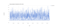
ชุดข้อมูลไม่มีคำอธิบาย