-
Building equity with digital tools: illuminating large-scale land acquisition and leasing for public view in Cambodia using a suite of online open-data tools
 กัมพูชา
Reports, journal articles, and research papers (including theses and dissertations)
Try Thy, David Hindley
2020
Online information, data, and tools are valuable resources for people struggling to retain equity in land ownership. Digital maps are critically important in a country where...
กัมพูชา
Reports, journal articles, and research papers (including theses and dissertations)
Try Thy, David Hindley
2020
Online information, data, and tools are valuable resources for people struggling to retain equity in land ownership. Digital maps are critically important in a country where...
-
Geology of Cambodia (2006)
กัมพูชา
23 กันยายน ค.ศ. 2016
แหล่งข้อมูล: Save Cambodia's Wildlife. *Atlas of Cambodia: maps on...
 This dataset provides known locations of geolocial sites in Cambodia.Geographic data is encoded in the WGS 84 coordinate reference system. Data were provided to ODC in vector...
-
Collateral damage: Land loss and abuses in Cambodia’s microfinance sector
 กัมพูชา
Reports, journal articles, and research papers (including theses and dissertations)
Cambodian League for the Promotion and Defense of Human Rights...
2019
Collateral Damage: Land Losses and Abuses in Cambodia’s Microfinance Sector details the size and scope of Cambodia’s MFI sector and seeks to highlight the human rights abuses...
กัมพูชา
Reports, journal articles, and research papers (including theses and dissertations)
Cambodian League for the Promotion and Defense of Human Rights...
2019
Collateral Damage: Land Losses and Abuses in Cambodia’s Microfinance Sector details the size and scope of Cambodia’s MFI sector and seeks to highlight the human rights abuses...
-
Mine/ERW casualties (2005- 2013)
กัมพูชา
30 มิถุนายน ค.ศ. 2020
แหล่งข้อมูล: Office for the Coordination of Humanitarian Affairs (OCHA) in Asia...
 This dataset shows information about locations of casualties caused by explosive remnants of war (ERW) and mines from 2005 to 2013 across Cambodia. Plus, it also includes number...
-
Mine and Explosive Remnant of War (ERW) accident casualties (2016-2017)
กัมพูชา
30 มิถุนายน ค.ศ. 2020
แหล่งข้อมูล: Monthly Report for December 2017 published by the Cambodian Mine...

ชุดข้อมูลไม่มีคำอธิบาย
-
Mine and Explosive Remnant of War (ERW) accident casualties (2018-2019)
กัมพูชา
23 มิถุนายน ค.ศ. 2020
แหล่งข้อมูล: Monthly Report for March 2017 published by the Cambodian Mine...

ชุดข้อมูลไม่มีคำอธิบาย
-
Systematic land registration in Cambodia (2013)
กัมพูชา
4 ตุลาคม ค.ศ. 15
แหล่งข้อมูล: Ministry of Land Management, Urban Planning and Construction. Land...
 This dataset describes the status of systematic land registration in Cambodia's communes by March 2013, as given in the Cambodian Ministry of Land Management's Land...
-
NGOs working on land tenure and titling issues in Cambodia
กัมพูชา
Reports, journal articles, and research papers (including theses and dissertations)
Open Development Cambodia
2015
A list of some NGOs working on land tenure and titling issues in Cambodia. Though Open Development Cambodia attempted to make this list as comprehensive as possible, the list...
-
Briefing Note on Business and Human Rights: Preventing, Mitigating and Remedying Land-Related Rights Violations in the Kingdom of Cambodia
กัมพูชา
Analysis, discussion papers, and blogs
Cambodian Center for Human Rights (CCHR)
2018
The purpose of this Briefing Note is to identify key issues pertaining to business human rights in Cambodia through the analysis of three land-related conflicts, and to propose...
-
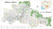
Pursat communal land use planning (CLUP) atlas 2009
กัมพูชา
18 เมษายน ค.ศ. 2017
แหล่งข้อมูล: Ministry of Land Management, Urban Planning and Construction...
 Pursat communal land use planning(CLUP) atlas (Chamraeun Phal, Kbal Trach, Me Tuek, Phteah Rung, Prongil, Roleab, Ta Lou, Tnaot Chum commune) is communal land use planning...
-
Koh Kong communal land use planning (CLUP) atlas 2009
กัมพูชา
18 เมษายน ค.ศ. 2017
แหล่งข้อมูล: Ministry of Land Management, Urban Planning and Construction...
 Koh Kong communal land use planning(CLUP) atlas (Andong Tuek, Chrouy Pras, Smach Mean Chey, Stung Veng, Tma Sa, and Trapeang Rung commune) is communal land use planning...
-
Ratanakiri communal land use planning (CLUP) atlas 2009
กัมพูชา
18 เมษายน ค.ศ. 2017
แหล่งข้อมูล: Ministry of Land Management, Urban Planning and Construction...
 Ratanakiri communal land use planning(CLUP) atlas (Aekakpheap, Ka Choun, Pong, Sameaki, Serei Mongkol, and Toen commune) is communal land use planning extracted from 2009...
-
Siem Reap communal land use planning (CLUP) atlas 2009
กัมพูชา
18 เมษายน ค.ศ. 2017
แหล่งข้อมูล: Ministry of Land Management, Urban Planning and Construction...
 Siem Reap communal land use planning(CLUP) atlas (Chan Sar, Doun Peaeng, Leang Dai, Nokor Pheas , Popel, Srae Khvav, Svay Chek, Tayaek commune) is communal land use planning...
-
Kampong Speu commune land use planning (CLUP) atlas 2009
กัมพูชา
29 มีนาคม ค.ศ. 2017
แหล่งข้อมูล: Ministry of Land Management, Urban Planning and Construction...
Kampong Speu commune land use planning(CLUP) atlas (Kiri Vaon, Moha Sang, Honorom, Prabei Mom, Prey Khmeng, and Yea Angk commune) is communal land use planning extracted from...
-
Kampong Cham communal land use planning (CLUP) atlas 2009
กัมพูชา
18 เมษายน ค.ศ. 2017
แหล่งข้อมูล: Ministry of Land Management, Urban Planning and Construction...
 Kampong Cham communal land use planning(CLUP) atlas (Chikor, Moung Riev, Roang, and Srak commune) is communal land use planning extracted from 2009 contained both detailed...
-
Mondulkiri communal land use planning (CLUP) atlas 2009
กัมพูชา
18 เมษายน ค.ศ. 2017
แหล่งข้อมูล: Ministry of Land Management, Urban Planning and Construction...
 Mondulkiri communal land use planning(CLUP) atlas (Dak Dam, Pu Chri, Saen Monourom, Srae Ampum, Srae Khtum, and Srae Preah commune) is communal land use planning extracted from...
-
Preah Sihanouk communal land use planning (CLUP) atlas 2009
กัมพูชา
18 เมษายน ค.ศ. 2017
แหล่งข้อมูล: Ministry of Land Management, Urban Planning and Construction...
Preah Sihanouk communal land use planning(CLUP) atlas (Angdoung Thma, Kampenh, Outreh, Samrong, and Tomnob Rolok commune) is communal land use planning extracted from 2009...
-
Kep communal land use planning (CLUP) atlas 2009
กัมพูชา
18 เมษายน ค.ศ. 2017
แหล่งข้อมูล: Ministry of Land Management, Urban Planning and Construction...
Kep communal land use planning(CLUP) atlas (Angkaol, Ou Krasar, and Pong Tuek commune) is communal land use planning extracted from 2009 contained both detailed current land...
-
Kratie communal land use planning (CLUP) atlas 2009
กัมพูชา
18 เมษายน ค.ศ. 2017
แหล่งข้อมูล: Ministry of Land Management, Urban Planning and Construction...
 Kratie communal land use planning(CLUP) atlas (Dar, Kbal Damrey, O Krieng, Ruessei Kaev, Saob, Srae Char, Svay Chreah, and Thmi commune) is communal land use planning extracted...