-
The third Science talk on "National forest monitoring system and forest inventory"
 Cambodia
Conference/workshop proceedings and presentations
This slide presentation focus on National Forest Monitoring System and Forest Inventory for the event of Science talk. The event provides an opportunity for participants from me...
Cambodia
Conference/workshop proceedings and presentations
This slide presentation focus on National Forest Monitoring System and Forest Inventory for the event of Science talk. The event provides an opportunity for participants from me...
-
Legal analysis of forest and land laws in Cambodia
 Cambodia
Reports, journal articles, and research papers (including theses and dissertations)
Oberndorf, R B
2006
From the foreword: "A major goal of CFI's mission in Cambodia is to support the involvement of civil society in the management of forests. Rural communities have a special role ...
Cambodia
Reports, journal articles, and research papers (including theses and dissertations)
Oberndorf, R B
2006
From the foreword: "A major goal of CFI's mission in Cambodia is to support the involvement of civil society in the management of forests. Rural communities have a special role ...
-
ASTER global digital elevation model (ASTER GDEM) in Cambodia
Cambodia
February 23, 2023
Source:
 The dataset of ASTER Global Digital Elevation Model (ASTER GDEM) places great emphasis on topographic information of the global terrain. As the ASTER was created with the global...
-
Digital Elevation Model from SRTM (Shuttle Radar Topography Mission) in Cambodia
Cambodia
February 10, 2023
Source:
 According to the Jet Propulsion Laboratory website, the source mentioned that on September 23, 2014, the White House announced the highest-resolution topographic data generated ...
-
Building equity with digital tools: illuminating large-scale land acquisition and leasing for public view in Cambodia using a suite of online open-data tools
Cambodia
Reports, journal articles, and research papers (including theses and dissertations)
Try Thy, David Hindley
2020
Online information, data, and tools are valuable resources for people struggling to retain equity in land ownership. Digital maps are critically important in a country where the...
-
Geology of Cambodia (2006)
Cambodia
September 23, 2016
Source: Save Cambodia's Wildlife. *Atlas of Cambodia: maps on...
 This dataset provides known locations of geolocial sites in Cambodia.Geographic data is encoded in the WGS 84 coordinate reference system. Data were provided to ODC in vector fo...
-
Forest cover in Cambodia (2015-2018)
Cambodia
June 13, 2018
Source: The forest monitoring system which is the product of collaboration...
 This forest cover is extracted from the Forest Monitoring System (https://rlcms-servir.adpc.net/en/forest-monitor/) which is developed by SERVIR-Mekong and the Global Land Anal...
-
Siem Reap city land use master plan for 2035 vision
Cambodia
March 5, 2019
Source: Official Facebook page of the Ministry of Land Management, Urban...
 This map shows the land use master plan of Siem Reap city for 2035 vision. It was officially adopted in 2018 by the Royal Government of Cambodia.
-
Classification and list of wildlife species
Cambodia
October 17, 2022
Source:
This dataset includes wildlife species as defined by Prakas No. 20 on the classification and list of wildlife species, which determined that all wildlife species in the Kingdom ...
-
Update on investment law in Cambodia
Cambodia
Analysis, discussion papers, and blogs
Darwin HEM, Chamnual MEAS
2022
Cambodia is located in Southeast Asia and it is bordered by Thailand, Laos, Vietnam, and the Gulf of Thailand, making it an ideal country for import and export operations. Amid ...
-
Solar power plant in Cambodia
Cambodia
August 16, 2022
Source: https://www.stimson.org/2020/mekong-infrastructure-tracker-tool/
 The dataset of a solar power plant in Cambodia is extracted from the Mekong Infrastructure Tracker Dashboard available in Cambodia. The solar power plants dataset involved the u...
-
Reserved land for social land concession
Cambodia
April 27, 2021
Source: Royal gazette: sub-decree and decisions (2006-2020).
 This dataset contains information on the reserved land for social land concession for civil people and military issued by Royal Government of Cambodia from 2006 to 2020. The lan...
-
Rainfall estimates from rain gauge and satellite observations (CHIRPS pentad dataset)
Cambodia
June 23, 2022
Source: The data is derived from...
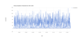 CHIRPS is an abbreviation for Climate Hazards Group InfraRed Precipitation with Station Data (Version 2.0 final). The CHIRPS is a 30+ year quasi-global rainfall dataset and inco...
-
Global Surface Water Data in Cambodia
Cambodia
February 5, 2022
Source:
 The Global Surface Water dataset from Joint Research Centre has a complete history of water detections over the 37-year period from 1984 to 2020 produced under the Copernicus Pr...
-
Collateral damage: Land loss and abuses in Cambodia’s microfinance sector
Cambodia
Reports, journal articles, and research papers (including theses and dissertations)
Cambodian League for the Promotion and Defense of Human Rights...
2019
Collateral Damage: Land Losses and Abuses in Cambodia’s Microfinance Sector details the size and scope of Cambodia’s MFI sector and seeks to highlight the human rights abuses th...
-
Population census 2019 (Final population totals)
Cambodia
September 27, 2021
Source: Official website of National Institute of Statistics...
 This dataset provides a final result census of the population in the Kingdom of Cambodia in 2019, which shows the total population, total population of males and females, total ...
-
Population census 2019 (Provisional population totals)
Cambodia
September 27, 2021
Source: Official website of National Institute of Statistics...
 This dataset provides a provisional census of the population in the Kingdom of Cambodia in 2019, which shows the total population, total population of males and females, total h...
-
Cambodia Disaster Management Reference Handbook 2017
Cambodia
Reports, journal articles, and research papers (including theses and dissertations)
Center for Excellence in Disaster Management & Humanitarian Assistance
2017
This report focuses on country overview, disaster overview, organizational structure for disaster management, infrastructure, health, woman, peace, and security.
-
Marine fisheries management area
Cambodia
April 22, 2021
Source: Prakas No 364 on establishment of management fishery area in Koh...
 This dataset shows the Cambodia's first large-scale marine protected area in order to enhance the protection of the marine biodiversity and fisheries livelihood within Archip...
-
Canals in Cambodia (2008)
Cambodia
October 26, 2016
Source: Office for the Coordination of Humanitarian Affairs (OCHA) in Asia...
 This dataset is included geographical locations of canals and types of canal such as earthen, levee and masonry. The data is released by Department of Geography of Ministry of L...